During February CodeCamp in Pilsen, there has been a brand new pilot web application launched. Jan Macura and Jáchym Kellar introduced an online tourism guide, which provides information about area of interest.

Fig. 1 – Main screen of the Smart tourist guide
User can search for data either by providing geographic name of the location or by hard typing the coordinates. Third option is to perform search around the current user location.
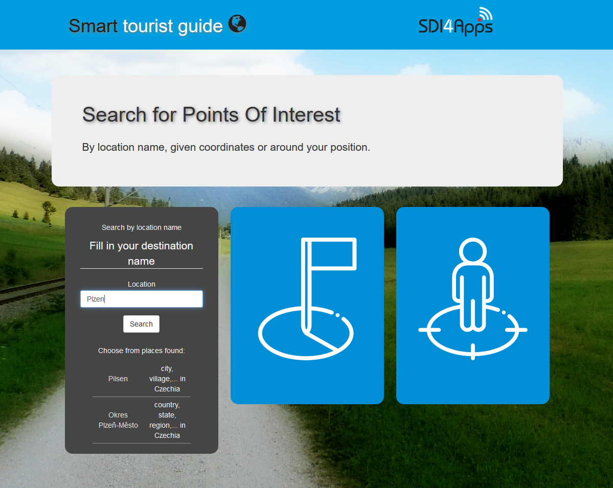
Fig. 2 – Opened form for providing geographic name of the location
After using whichever option, the points of interest appear on the map. Results are clustered for better readability and each set of results is stored in a different layer, so the user can switch them on or off and investigate them at any time.
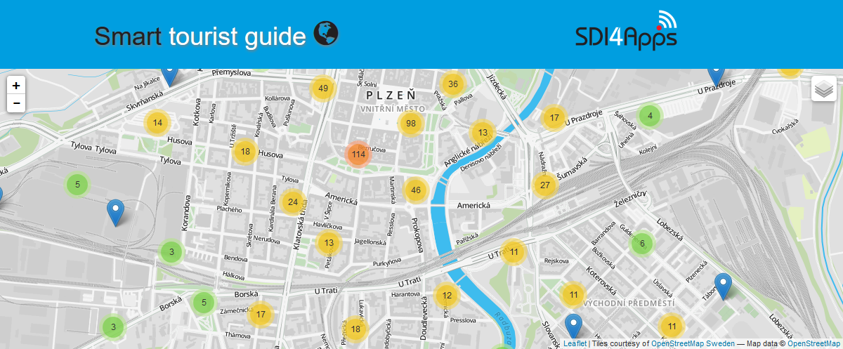
Fig. 3 – Preview of map window with loaded point of interest
The page displays also other information like weather forecast for the next 48 hours in the area and the list of all POIs which were found. User can then filter the results by categories.
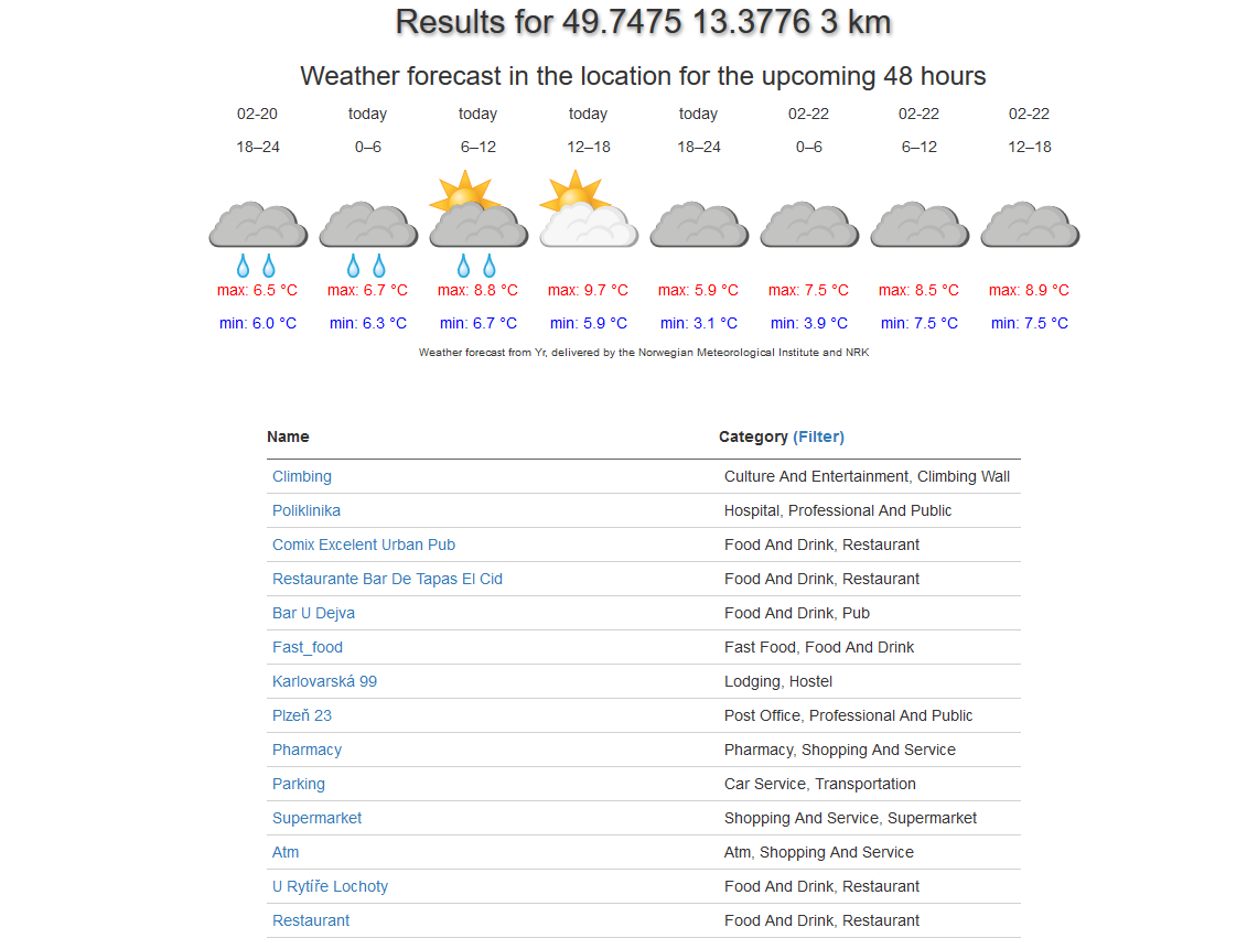
Fig. 4 – Preview of list of result POIs
It is also possible to download the data in a form of GeoJSON or KML file and store them locally or upload them to many maps or GIS services.
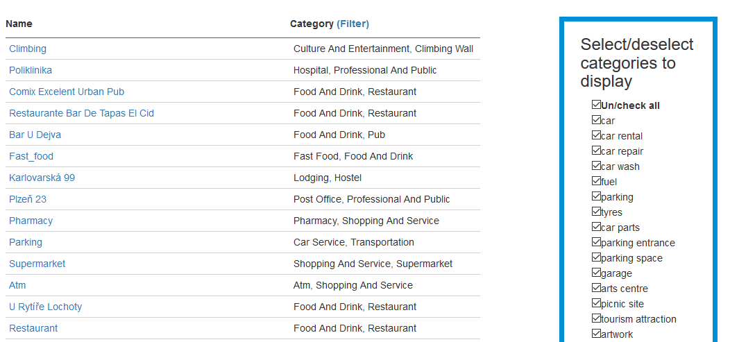
Fig. 5 – Preview of list of result POIs with filtering options
The application fetch the data from SPOI dataset and uses other public REST APIs like norwegian Yr for weather forecast or GeoNames Web Service to match geographic names. Many things are still subject to further improvements.
And of course, you can look and freely test the Smart tourist guide application on your own. If you are interested in contributing during development or just use it you can visit repository on GitHub.
Jan Macura (UWB), Jáchym Kellar (UWB)


