Leader: Vidzeme Planning Region, Latvia
Contact person: RNDr. Karel Charvát, Charvat@ccss.cz
OVERVIEW:
The Open Land Use Map (OLU) pilot creates an open available pan-European map of land use that will be available for users in some popular formats for geodata sharing (OGC services: WMS/WFS, Shapefile or KML).
The lack of land use data on local level led to an idea of combining data from various sources and of different levels of detail into a seamless map. This idea came up from previously executed project Plan4business and was turned into a pilot application (Pilot IV: Open Land Use Map through Volunteered Geographic Information) by SDI4Apps. The innovative aspect of the pilot is not only in the methodology of combining data into a seamless database, but also in using crowdsourcing for data collection and update. An important aspect is that data are available as open data.
The methodology is simple:
- All available open data from a certain territory are collected and stored in a database.
- These data are harmonized into a common data model based on the INSPIRE data specifications on land use and using the same HILUCS classification.
- Data of the highest level of detail (usually not covering the entire territory) are combined with data with second highest level of detail and so on (see the figure below).
- Data are published for download and as a WMS service.
- Data are updated through crowdsourcing, either online based on remote sensing images or directly in the field through a mobile application (not yet implemented).
The aim is to cover the entire Europe and then extend it to a global dataset. The first territories that are completed include the Czech Republic, Latvia, Slovakia and part of Belgium. The individual cases are described below including some ideas for future development and data reuse.
The created Open Land Use Map data are available as OGC services and can be downloaded as Shapefiles (currently only for the Czech Republic and Latvia).

Open Land Use Map shapefiles
Open Land Use Map of the Czech Republic
The following open data sources were used to create the Czech OLU:
- Digital cadastre data (RUIAN, highest level of detail)
- Land Parcel Identification System (LPIS)
- Urban Atlas
- CORINE Land Cover
The steps undertaken for combining the data are shown in the following figure:
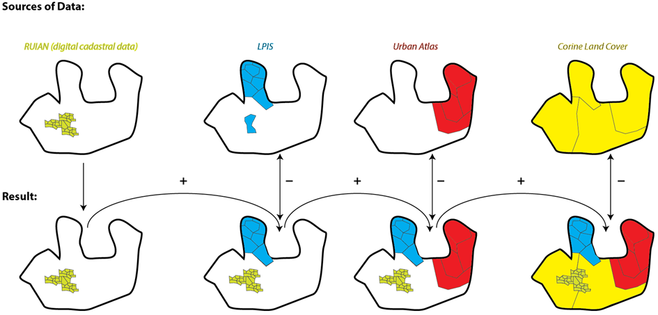
OLU Map sources of data
As a result a seamless map covering the entire territory of the Czech Republic has been created and is available at sdi4apps.eu/open_land_use.
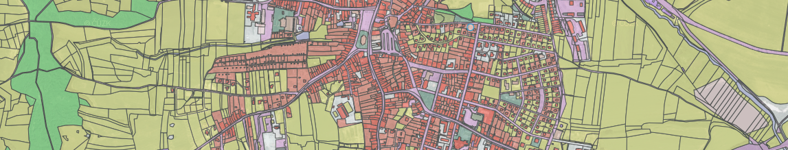
OLU Map Czech Republic
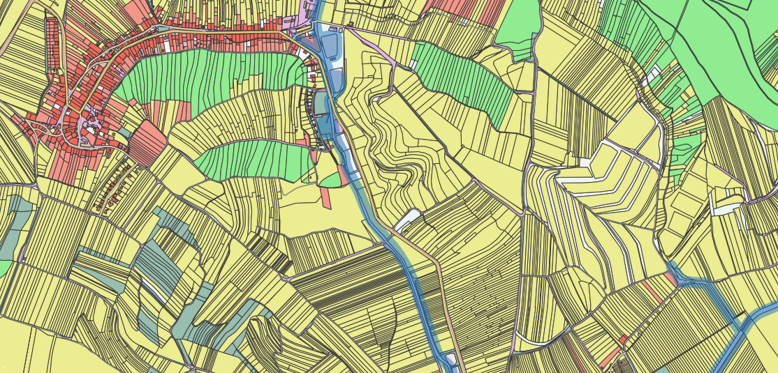
Open Land Use Map of Latvia and Slovakia
Similarly as in the Czech Republic, Slovakian and Latvian OLU has been produced using the following open datasets:
Latvian OLU is available at sdi4apps.eu/open_land_use_lv:
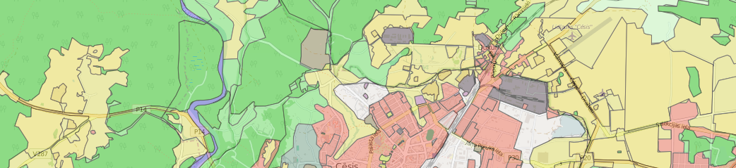
OLU Map Latvia
Slovakian OLU is available at sdi4apps.eu/open_land_use_sk:
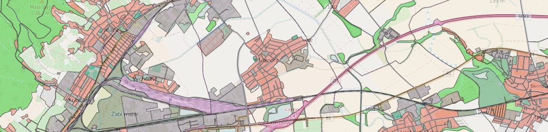
OLU Map Slovakia
Open Land Use Map of Flanders (Belgium)
In this case, a large scale topographic database (GRBgis) has been for OLU production. The dataset doesn’t include land use information for every area so in many cases only the geometrical part of the database has been used and information on land use was derived from another data source. This data source was the Urban Atlas.
As a result the OLU for Flanders has been created and is currently accessible as WMS service.
OLU Map Flanders
Exploitation and reuse
During the second year of the SDI4Apps project, a number of scenarios was tested in cooperation with the OpenTransportNet and FOODIE projects.
An example of brownfield mapping:
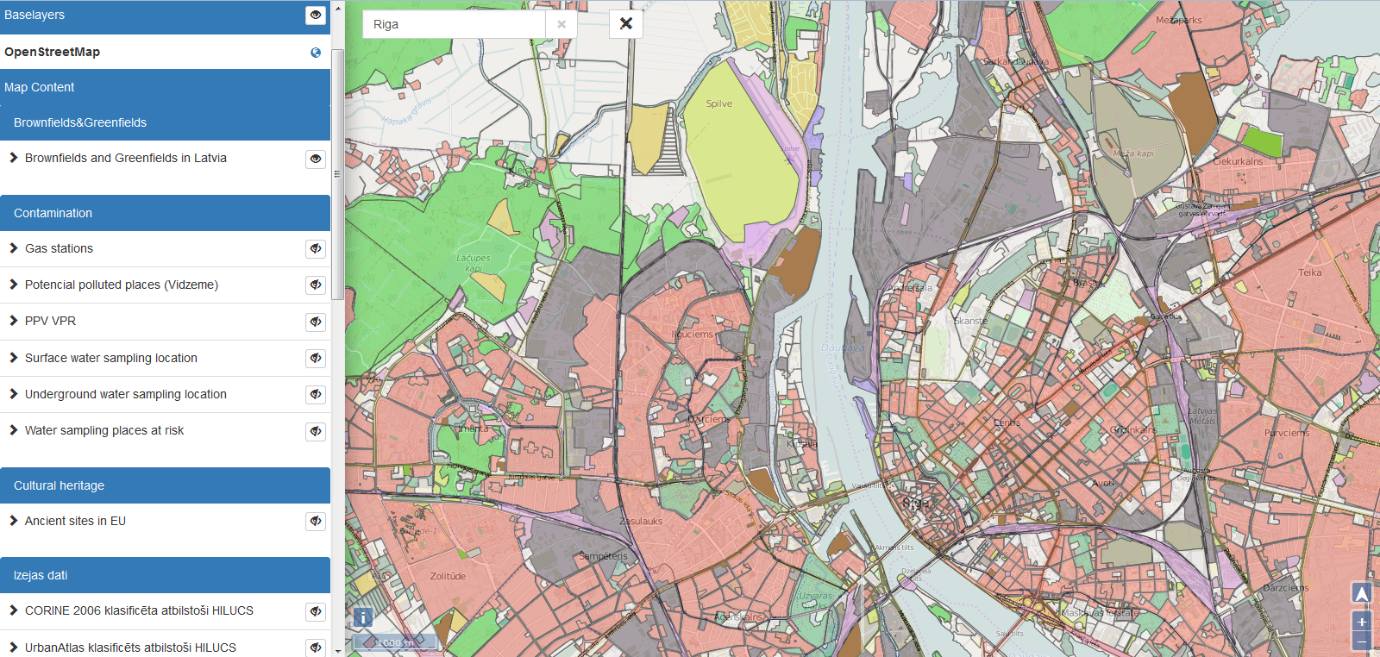
OLU brownfield mapping
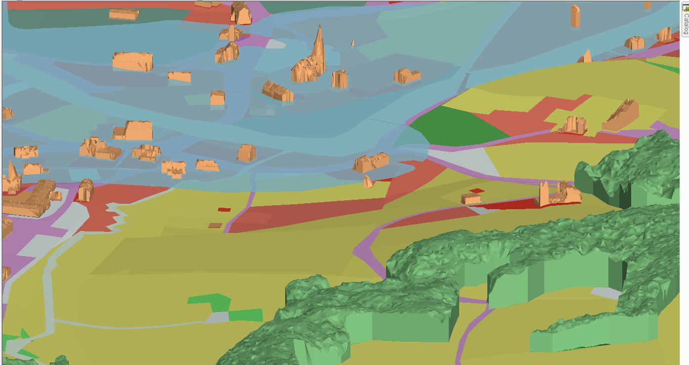
3D visualisation:
OLU Map 3D visualisation
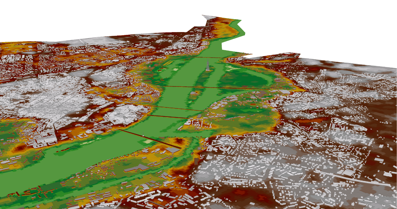
3D modelling of flood plains:
OLU Map 3D modelling of flood plains
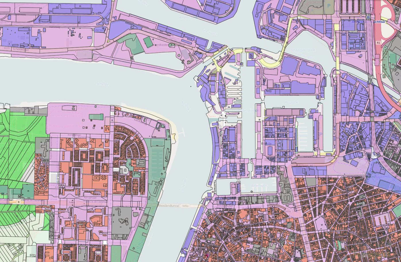
Monitoring of transport intensity in dependency of land use (Antwerps):

OLU Map transport intensity monitoring
The number of passengers travelling on different bus lines and boarding buses at different stops and times of day in Riga:
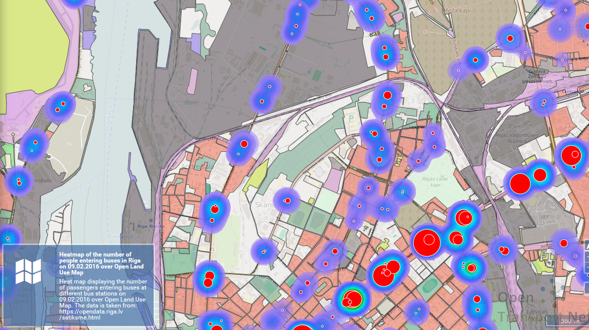
OLU Map bus passenger traffic
Open Land Use could be also used by farmers for planning their production:
OLU Map farm production planning
Open Land Use and NDVI index from Landsat 8:
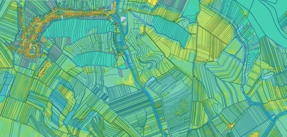
Open Land Use and NDVI


