Leader: The National Microelectronics Applications Centre LTD
Contact person: Dr. John J O’Flaherty (john@mac.ie), Technical Director, MAC Ltd
OVERVIEW:
The Easy Data Access Pilot applications aim to support easy access to existing services using the SDI4Apps platform API solution, which supports easy collection of information using smart phones and integrates this information into current SDIs, by implementing the European Tourism Indicators System (ETIS) and Ground Truthing services in the Burren National GeoPark in Ireland.
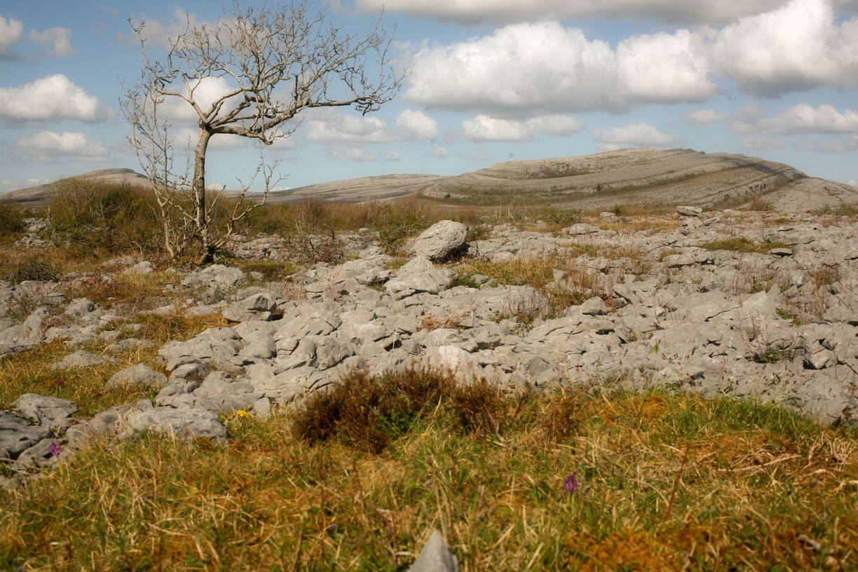
Burren National Park (photo: Liam Lysaght)
Social Validation/Co-design meetings and discussions with the GeoPark stakeholder groups identified the following two User Services as providing the most immediately useful benefit/added value to help sustainable tourism and protect heritage sites in the Park and beyond.
1: Mobile Apps to support Tourism for Conservation (ETIS Service)
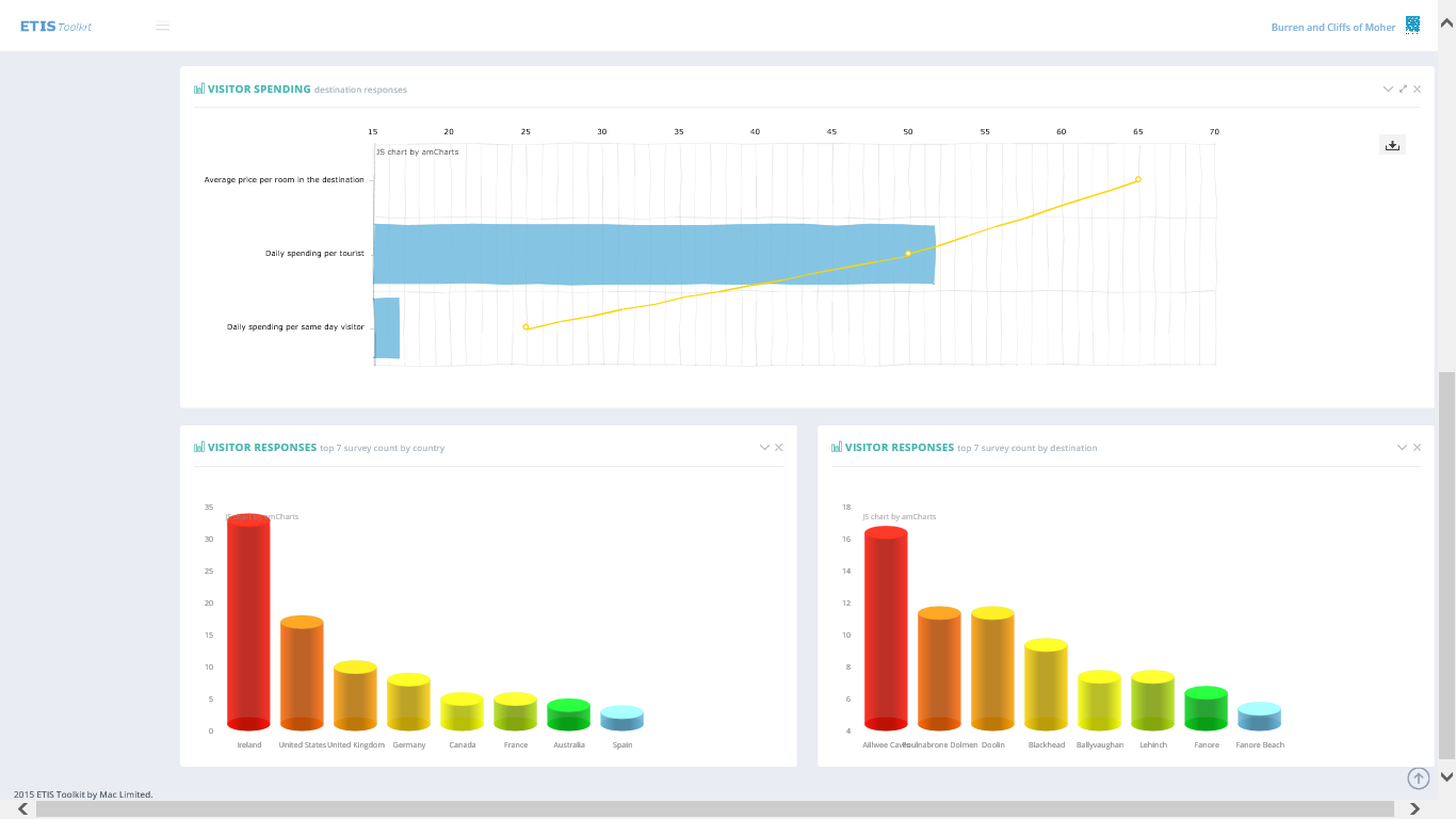
SDI4Apps enables an European Tourism Indicators System (ETIS) Webservice and Apps for the Burren and European GeoParks Network. ETIS is a new EU standard , that is a local community led process for monitoring, managing, and enhancing the sustainability of a tourism destination. SDI4Apps enables streamlining and enhancing the current manual system by transforming it to Linked Open Geospatial Data. SDI4Apps enables the provision of a webservice and multiple easy-access/VGI Apps for the various stakeholders involved, including:
- Public bodies – National Parks Wildlife Service (NPWS)
- Experts – Researchers and management in the Burren GeoPark, GeoParks Network
- Enterprises, Companies and SMEs – Burren GeoPark
- Citizens – visitors to the Burren National Park
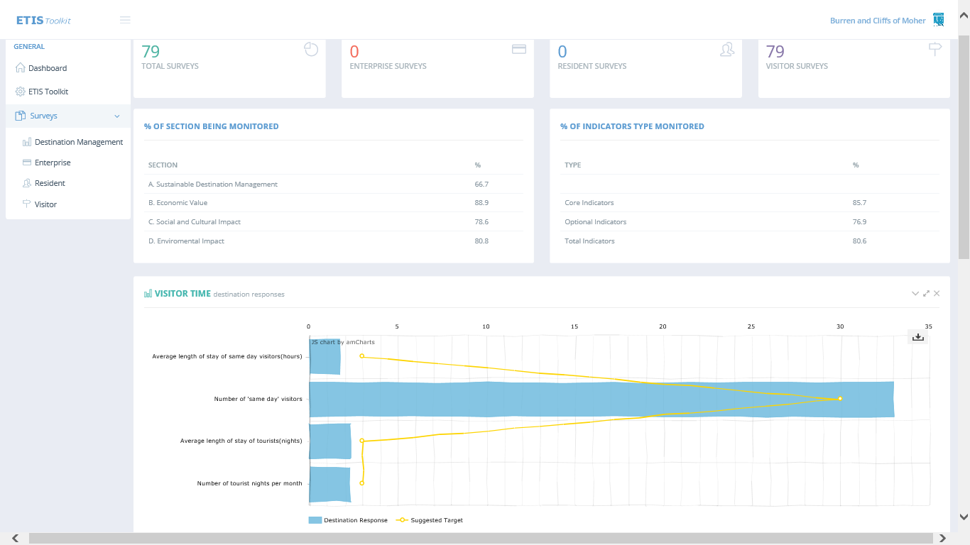
The service dashboard is available at www.ETISapp.eu , while each of the ETIS stakeholders surveys are at:
- Visitor /visitorsurvey
- Resident /residentsurvey
- Enterprise /enterprizesurvey
Screen captures, please click thumbnail images to view larger:
-
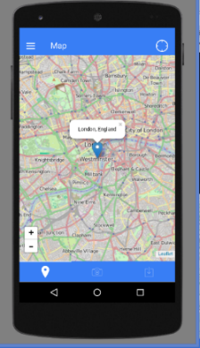
- ETIS app portal screen capture
-
- ETIS app portal screen capture
-
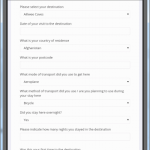
- ETIS app screen capture

2: Mobile App for Protected Heritage Sites (Ground Truthing Service)
SDI4Apps enables a service to Ground-Truth potential Protected Monument sites, empowering visitors and people interested in their local heritage, to seek out and ground truth potential Monument sites. Ground Truthing is the Crowdsourcing/VGI process of gathering data in the field, to either complement or dispute remotely collected data. This will mobilise a very motivated community of stakeholders, including:
- Public bodies – Heritage Council, National Monuments Service, Irish Government Department of Arts, Heritage and the Gaeltacht
- Experts – Field Monuments Advisors and Researchers
- Enterprises, Companies and SMEs – Farmers
- Citizens – visitors and people interested in their local heritage
The Ground Truthing service portal is available at www.GroundTruthing.eu, click thumbnail images to view larger:
-
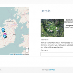
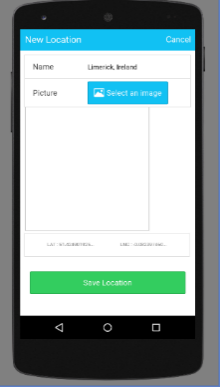
- Ground Truthing portal screen capture

-
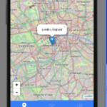
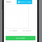
- Ground Truthing app screen capture
-
- Ground Truthing app screen capture
The service uses the SPOI data model from Open Smart Tourist Data Pilot and interfaces to the Irish National Monuments dataset. While the ETIS dataset is defined as an Excel Spreadsheet & PDF Guide at bookshop.europa.eu, both services use the following external open datasets;
- EU Open Data Portal
- Eurostat Linked Data
- GeoNames
- Irish Heritage Council heritage maps
- Irish Open Government Data Portal
- Irish Spatial Data Exchange (ISDE)
- Logainm Placenames Database of Ireland – LOD
- National Biodiversity Data Centre Ireland
- Open Street Map
The SDI4App Platform’s functionality that the Pilot’s services use include:
- Map module
- Information retrieval module
- Advanced visualization module
- Mobile module
- Data harmonization module
- Semantic tools for LOD data harmonization module
The Pilot’s services derive particular benefit from the following SD4Apps Enhanced Enablers:
- Feature Synchronising Service – To check-in/out data from Postgres in GeoJSON.
- Background Map Service – Light smart MVtiled maps from OSM in user’s device.
These greatly improved the asynchronous operation of the mobile services, particularly in the Burren rural environment of the Pilot, where 3G/4G data communications can often be lost.
The external Communities of Partners, Customers and Users of the Pilot’s services include the following:
| Stakeholders | ETIS Service | Ground Truthing Svc | Roles |
|---|---|---|---|
| Public bodies | National Parks Wildlife Service (NPWS) |
|
|
| Experts |
|
|
|
| SMEs, Enterprises & Companies |
|
|
|
| Citizens |
|
|
|
The Success Criteria for these communities’ involvement in the Easy Access Pilot include:
- Easy collection of information using smart phones and LOD.
- Integrate data from users, OD, crowd-sourced and social media.
- Reuse and share tourist information resources, channels and tools.
- Integration of VGI into existing SDIs and LOD.
- Increased access to harmonised and interoperable GI, L/OD and VGI data.
- Usage level and Social Validation of Services that use SDI4Apps.
- New tourism activities, visitors and jobs, and SME developed services.
- SMEs, Students and Researchers developing new Apps and Services.
The Innovative Aspects of the Easy Data Access Pilot with respect to state-of-the-art of the 2 Pilot services are:
- Both services:
- use the SDI4Apps Enablers and Cloud-based scalable platform
- came out of a social validation process with the relevant external stakeholders
- are based on Linked Data principles & Linked Open Data sources
- apps use an open framework that enables them to be adapted to various mobile devices, & evolving SDI4Apps Enablers & platform
- use the SDI4Apps Enablers and Cloud-based scalable platform
- ETIS is the first implementation of the standard that the EU hopes will be used Europe-wide for all Sustainable Destinations.
- The Monuments Ground-Truthing Service is expected to totally change how the Monument Field Officers operate in Ireland.
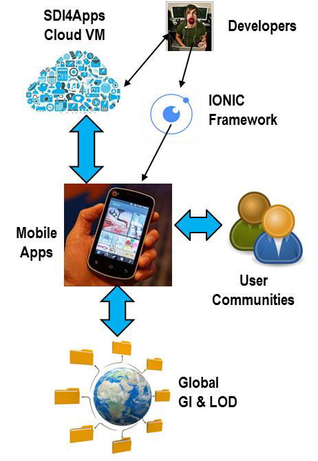
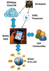
Both Easy Access services were developed as hybrid asynchronous apps written in open source AngularJS, using the open source IONIC HTML5 native app development framework compiled to native code for the various mobile platforms (Android, IOS, Windows) using the open source Apache CORDOVA plugins. This framework approach decouples the client application from the backend architecture, so the Easy Easy Access services could be trialed and developed with users, while their backends were able to use SDI4Apps Enablers, as they evolved.


