16–18 March 2016, Riga Latvia
Thank you for participating!
The hackaton is now over, please see below for minutes from the organiser.
Hackathon results
The jury (see the members below) selected the first three winning applications in this order:
- Pavel Hajek, Jan Macura, František Kolovský – Ideas and Data from Open Riga
- Pavel Hajek, Jan Macura, Jakub Kočica, Irena Košková, Rinor Shala – 3D Model of Buildings Automatically Created from Open Datasets
- Karel Charvat Jr, Vojtěch Lukas – Estimation of Crop Yield Potential
Other applications developed during the hackathon include:
Martin Tuchyňa, Tomáš Kliment – Ecosystem Services (ESS)
Dmitrii Kozuch, Irena Košková, Otakar Čerba, Dainis Keilis, Raitis Bērziņš – Use of Linked Open Data for Educational Purposes
Martin Tuchyňa, Tomáš Kliment, Jakub Kocica, Dmitrii Kozuch – Slovakian Open Land Use
Richards Gailums, Klāvs Taube, František Kolovský, Kristaps Krūmiņš, Pavel Hajek – Drivenet Maps – Open Data Real-time Road Maps for Autonomous Driving from 3D LIDAR Point Clouds
Aldis Bulis, Mārtiņš Dudelis – IT system for development of national economy in the 21st century
Jury Members
Kaspars Skalbergs (Baltic Open Solutions Center, Latvia)
Anna Builo-Hoļme (Zemgale Planning Region, Latvia)
Inga Bērziņa (Farmers Parliament, Latvia)
Sarmīte Barvika (Riga Technical University, Latvia)
Kristaps Ročāns (Vidzeme Planning Region, Latvia)
Best Online Apps
The public were invited to vote for the best app, through an online form. The result, at least in the case of the first three places, is exactly the same as the final decision of the jury that evaluated all 7 applications in Riga during the event. The people’s choice of Best app of the Baltic Open (Geo) Data Hackathon 2016 is: Ideas and Data from Open Riga (Pavel Hajek, Jan Macura, František Kolovský, Dmitrii Kozuch, Agris Snepsts, Danis Kreilis). See the full voting result here.
Original inviation below:

Programmer’s fuel (Vincent Brown, CC BY 2.0); code snippet by Asplan Viak Internet
The importance of open data and open geodata is increasing. But the potential of open (geo) data has not been fully exploited. This is true in most parts of Europe including the Baltic Region. Similar conditions relate also to the software tools helping to collect, manipulate and publish such data. There is a need to address these challenges and where possible to improve this situation. For this reason, the Baltic Open (Geo) Data Hackathon is organised.
In order to prove the potential of open (geo) data, your contributions, expertise and knowledge are needed! Identify possibilities of open (geo) data exploitation, pitch new ideas, promote your data, re-use available open (geo) data & software technologies to create new data, software, apps, or visualisations. Provide the proposals/expectations for the hackathon. And, last but not least, meet new people and spent three wonderful days in Riga.
Who we are looking for?
A hackathon is very often understood as some exercises of programmers or data specialists. The Baltic Open Data Hackathon extends this approach by inviting also end users. So we are looking for different types of developers, data specialists and users from different fields, not limited to the following ones:
- Open data providers
- Web GIS developers
- Web designers
- Semantic web experts
- Database experts
- User interaction experts
- Mobile developers
- Developers of apps in different areas like transport, tourism agriculture, planning
- Hardware experts focused on sensors, communication and machinery tracking
- GIS specialists for analysis
- Geographers
- Earth observation experts
- Experts on land use, landscape and land cover
- Spatial and urban planers
- Transport planners and managers
- Agronomist and farmers
- Travel agencies and tourism specialists
- Regional development agencies
- Environment protection experts
- Managers and investors interested to check or find new ideas
- Marketing experts
- Data journalists
Anyone of you can come with ideas and look for team members and data to realise your plans!
How to present your ideas?
You have two possibilities to present your ideas and attract potential team members:
- First, you can promote your ideas in advance through the SDI4Apps developers’ blog. All contributions will be distributed through LinkedIn and Facebook pages. This is a chance to discuss and prepare your project and build your team in advance.
- The second option is to present your idea during the hackathon. Everybody will be given a chance to prepare their own 5 minute pitch to attract other team members.
What data will be available?
The SDI4Apps, OpenTransportNet and FOODIE projects and other partners will provide sets of available open data. However, hackathon activities will not be limited to these data sets. A preliminary list of available data include:
- Open Land Use (link 1, link 2)
- Smart Points of Interest (link)
- Open Transport Map (link)
- Satellite data from Landsat and Copernicus
- DanubeHack list of Data and Catalogues (link)
- OpenStreetMap (link)
- Wikidata (link)
- DBpedia (link)
Latvian open data sources:
- Register of enterprises (link)
- The Procurement Monitoring Register (link)
- Riga open data catalogue (link)
- Regional indicator model (link)
- Municipalities data providing service (link)
- Nature data management system OAK (link)
- Statistics database (link)
- State budget (link)
- Election results (link)
- “Latvia’s State Forests” (LVM) open data (link)
Data sources will be added here.
What tools will be available?
The SDI4Apps, OpenTransportNet and FOODIE projects will offer you also a set of tools and open source software, which will be able to help you with building new solutions. However, hackathon activities will not be limited to these tools and you are free to use any other tools you like. A preliminary list of tools includes:
- HSlayers NG (link, more information here)
- WebGLayer – an advanced geovisualization API (link, more information here)
- SensLog – a solution for sensor networks (link, more information here)
- Layman LayMan – The Layer Manager (link, more information here)
- Sensor catalogue
- INSPIRE metadata in CKAN extensions (link, more information here)
- DanubeHack tools (link)
Any other tools will be added here. Experts on the above mentioned tools will be ready to help you with any difficulties.
Dates and venue
16–17 March 2016: Riga Technical University, Architecture and Urban Planning Faculty, 3rd floor, premise nr. 306, Kipsalas street 6, Riga
18 March 2016: University of Latvia, Raina bulvaris 19, 4th floor, premise nr. 415, Riga
Tentative programme
- Wednesday 16th March 2016
- 09:00–10:00 Opening of Baltic Open Data Hackathon, Introduction of the aim, introduction of available tools and data
- 10:00–11:00 Presentation about potential ideas for development
- 11:00–13:00 Teambuilding and lunch
- 13:00–19:00 Coding
- Thursday 17th March 2016
- 09:00–19:00 Coding (refreshment will be available during the day), and presenting preliminary results
- Friday 18th March 2016
- 10:00–10:30 Registration, opening the conference
- 10:30–10:50 Presentation about existing situation in open data in Latvia/ Toms Ceļmillers / Ministry of Environmental Protection and Regional Development, Electronic Government Department, Information Society Policy Unit
- 10:50–11:20 Presentation about the SDI4apps projects and its results/ Karel Charvat, Czech Centre for Science and Society, project representative
- 11:20–12:00 Presentation of hackathon results by teams
- 12:00–12:45 Coffee break
- 12:45–14:00 Presentation of hackathon results by teams, awarding of best team projects, and closing the event
Working language
English
Moderator
Karel Charvat
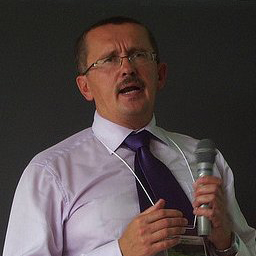
Karel Charvat
Karel Charvat is project manager of Czech Centre for Science and Society, WirelessInfo, Help Service Remote Sensing and Baltic Open Solution Centre and vice chairman of Club of Ossiach. He studied on Mathematical Physical Faculty of Charles University in Prague topic theoretical cybernetics, where he received degree Doctor in theoretical cybernetics.
He is member of CSITA. In period 2005–2007 he was President of European Federation for Information Technology in Agriculture Food and Environment (EFITA).
Karel has participated in more than 30 European projects. He was coordinator of several EC projects (WirelessInfo, PremathMod, NaturNet Redime, Naturnet Plus) and also technical coordinator of other projects (Plan4all, FOODIE, SDI4Apps). He has also large experience as evaluator of EC projects.
His key qualification are project management, Open Data, ICT for Agriculture and Environment, International cooperation, SDI design, strategic studies and management of projects in ICT and SDI. He has more than 200 publications and he is co-author of seven books.
Mentors

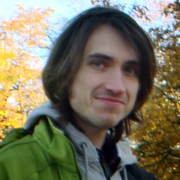
Premysl Vohnout
Premysl Vohnout
Premysl Vohnout works as software engineer at consortium around CCSS, BOSC and HSRS companies. This consortium is specialized in R&D in agriculture, environmental and tourist areas.
Mr Vohnout studied Geomatics at University of West Bohemia, Czech Republic, with specialization of GIS. He finished in 2009 with thesis “Server for Old Maps”. He participated in several European projects in FP7 and CIP calls. Those projects were mainly in themes of risk management (BRISEIDE, ERRA PPRD), agriculture (FOODIE, AMI4FOR), spatial planning (Plan4all, plan4business) and others.
He is developing applications mainly in JavaScript (AngularJS, ExtJS), python, PHP. He is co-developing with Raitis Berzins HSLayers-NG mapping framework.
(Stein) Runar Bergheim

(Stein) Runar Bergheim
(Stein) Runar Bergheim is co-founder and director of research and development at Norwegian technology company Asplan Viak Internet, a part of the Asplan Viak group, a Norwegian consultancy house whose roots go back to 1958. Outside of Europe, Bergheim works through the international consulting partnership NORPLAN.
Mr Bergheim studied landscape management, spatial planning and GIS at Sogn og Fjordane University College and later went on to work for Sogn og Fjordane County Council as a GIS consultant. Here he took an interest in the application of GIS within spatial planning. In 2001 he co-founded Asplan Viak Internet (AVINET) to bring web map solutions to the Norwegian market and as a vessel for applied research and development within GIS. From 2002 Mr Bergheim was managing director of AVINET before he in 2008 directed his energy towards large scale projects for NORPLAN in the United Arab Emirates and the Sultanate of Oman.
During the span of his career, Mr Bergheim has undertaken more than two hundred assignments in twenty countries. His key areas of expertise are design, supervision and management of information technology projects with four professional focal points: planning, land management, heritage and learning. His personal forte is to bridge the gap between technical and non-technical mindsets.
Raitis Bērziņš
Mr Bergheim is a frequently used speaker at national and international conferences and events. He has also been a guest lecturer in GIS at Sogn og Fjordane University College as well as at the University of Tromsø.
Currently, Mr Bergheim shares his time between Brussels, Abu Dhabi and Muscat. In Europe, he plays an active role in projects related to INSPIRE and EUROPEANA; on the Arabian Peninsula, he is supporting the implementation of new street addressing systems in the capitals of UAE and Oman.
Raitis Bērziņs
Raitis Bērziņs is a developer of web GIS systems interested in semantic databases and various computer graphics solutions. He can help with questions regarding JavaScript, Hslayers mapping library and SPARQL technologies.
Main organiser
Additional organisers

![]()


")

Supporters


Open Riga