Leader: University of West Bohemia
Contact person: Dr. Otakar Cerba, Ota.Cerba@gmail.com
OVERVIEW:
This pilot focus is on collecting, integrating and presenting tourist related data. This can be then further reused for various applications. The main target users include travel agencies, tourists, cyclists, car navigation providers, researchers and scientists.
The pilot application is a practical and useful subset from the wide range of outputs of tourist data related projects. It covers and integrates the following items:
- a wide range of input data sets, including OpenStreetMap or local data resources;
- design and modify processing, harmonization and exploitation methods and implement standards (for example existing vocabularies or formats used in the Linked data sphere);
- improve the presentation of results and communication between participants in the tourist industry;
- develop and implement business methodologies and procedures;
- evaluate the effectiveness of the SDI4Apps solution, and limits and benefits of the solution in comparison with existing
technologies; - reuse of results from the international and local projects (for example Habitats, CentraLab) and cooperation with E.L.F.
As a current result, there were two large datasets created including:
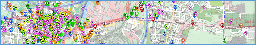
- Smart Points of Interest (SPOI) – a collection of existing points of interest. The current version covers almost all European countries and contains more than 23m records. They were adopted from OpenStreetMap and local resources such as data provided by Uhlava (a partner of the SDI4apps project). The data are provided in the RDF (Resource Descriptor Framework) format with use of several standards or respected features (for example RDFS, Basic Geo Vocabulary, Simple Features Topological Relations or classification used in Waze or OpenStreetMap software). The visualization and querying is provided by Virtuoso server and HS Layers.
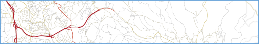
- Open Transport Map (OTM) – developed together with the OpenTransportNet project. The OTM allows routing and dynamic visualisation of traffic volumes. It also offers many other ways of innovative exploitation. The underlying data are accessible in an open INSPIRE compatible format.